

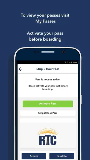
When I first opened RideRTC, I treated it less like a general travel planner and more like a practical companion for moving around Southern Nevada. That distinction matters. The app is built by RTC of Southern Nevada, and its purpose is to bring local transit information into one place for residents and visitors. If you are trying to understand how to get from a hotel, home, airport area, or attraction to another part of the region without relying entirely on a car, it gives you a useful starting point.
My overall impression is positive, although not effortless. The app is free, aimed at everyone, and has reached over a million installs, which makes it a familiar choice for people who need local transportation help. Its average rating is 3.7, a fair reflection of the experience: the core idea is valuable, but transit apps are only as reassuring as their route information, presentation, and performance at the exact moment you need them.
Getting from installation to a useful trip
What to expect before planning anything
RideRTC is a Travel & Local app rather than a broad vacation planner. I would not install it expecting hotel recommendations, restaurant discovery, or a complete sightseeing guide. Its value is much narrower and more practical: helping you approach public transportation in Southern Nevada with less guesswork.
That focus is especially helpful for visitors who know their destination but do not know the local transit network. A person staying near the Las Vegas Strip, for example, may understand where a venue is but still be unsure which transit option makes sense, where to begin, or how much planning is needed. A local resident may use it differently, checking a familiar route while comparing public transit with driving or a rideshare.
The app has been available since September 2016 and is currently at version 7.9.6. It supports devices running Android 8.0 or later. Those details are worth checking before you travel, particularly if you are using an older phone that has been kept for occasional trips. On a current device, the more important question is not whether the app is complicated, but whether you are willing to use a transit-focused tool instead of opening a general map app and accepting its first suggestion.
For me, the strongest reason to choose RideRTC is local concentration. A general mapping application can be excellent for comparing walking, driving, cycling, and public transportation across many cities, but it can also bury local transit information among unrelated choices. RideRTC feels more appropriate when your trip is specifically about Southern Nevada transit and you want the local service to be the center of the planning process.
There is also a useful trade-off here. The narrower focus can make the app more relevant, but it means it is not a complete replacement for a map, a hotel concierge, or your own knowledge of the destination. I would use it to answer “How do I travel there by local transit?” rather than “What should I do today?”
The first setup: keep the starting point simple
After installing it, I recommend beginning with one real journey instead of exploring every screen immediately. Pick a destination you already recognize, such as your accommodation, workplace, or a major attraction. This gives you an easy way to judge whether the route presentation makes sense without the extra stress of an unfamiliar address.
Type the starting point as precisely as you can. A broad landmark may produce a workable route, but a specific entrance, street, or nearby stop can make the result more useful. This is one of the first places where new users can become confused: a route that looks correct on a map may still require a longer walk than expected if the selected starting point is on the wrong side of a large property.
I also suggest checking the walking portions before committing to the journey. Public transit planning is not only about the vehicle segment. You may need to reach the stop, transfer between services, and walk again at the end. For a visitor carrying luggage, traveling with children, or dealing with strong heat, that walking detail can change a route from convenient to impractical.
Rather than planning only from your hotel to a destination, try the reverse direction as well. The outbound journey may be easy to understand, while the return trip may involve a different stop, a different transfer, or a less obvious departure point. This reverse-check is a small habit, but it is one of the most useful ways to avoid discovering a problem late at night after an event.
My setup tip is to plan the return journey before you leave. That turns the app from a one-way search tool into part of a complete outing plan. It also gives you a chance to save or note the important details while you still have a reliable connection and enough time to think.
Your first successful action should be deliberately ordinary
For a first test, I would choose a short, familiar trip rather than a complicated cross-city journey. Enter a nearby starting point and a destination you can identify easily, then inspect the suggested route from beginning to end. The goal is not merely to see a line on a screen. The goal is to understand the sequence: where you begin walking, where you board, whether a transfer is involved, and where the final walk ends.
This approach makes the first meaningful success reassuring. Once you can follow one simple journey, you have a better basis for using the app during a more important trip. If the first route feels unclear, that is the right time to adjust your search, choose a better-known stop, or compare the result with a physical landmark before you are standing outside with limited time.
One practical scenario shows where the app can earn its place. Imagine arriving in Southern Nevada for a short visit and wanting to travel from your accommodation to an evening reservation. Instead of opening a map only when you are ready to leave, I would check the route earlier, inspect the walking sections, and then repeat the search for the return trip. If the evening plan changes, I would use the same workflow with the new destination rather than assuming the original route still fits.
For a resident, the successful action may be even less dramatic: checking a regular commute or an occasional trip to a busy area. That is useful because familiarity with the app grows through low-pressure journeys. You learn how it presents local transit before depending on it for a time-sensitive appointment.
Do not judge the app only by how quickly it produces a route. The better test is whether you can explain the route to yourself without reopening the search every few minutes. If you know the first walking direction, the boarding point, the transfer requirement, and the final approach, the app has done something genuinely useful.
Where first-time users commonly get confused
The biggest source of friction is usually the difference between a destination and its nearest practical stop. A venue can cover a large area, and the route may end at a point that is technically close but not the entrance you expected. When the destination matters, I would treat the final walking section as part of the route, not as an afterthought.
Transfers deserve the same attention. A route with one change can be perfectly manageable, but only if you understand where that change happens and whether you need to walk between stops. New users often see a compact itinerary and assume every step is equally obvious. In practice, the transfer is the part I would inspect most carefully.
Another common mistake is planning too tightly around an appointment or event. Transit travel includes walking, waiting, and the possibility of a missed connection. RideRTC can help you organize the journey, but it cannot remove the need for a sensible time cushion. I would rather arrive early than build a schedule that works only if every part of the trip lines up perfectly.
Visitors should also remember that a route recommendation is not the same as local orientation. If you are unfamiliar with Southern Nevada, look up the surrounding area separately when necessary. The app can help with the transit portion, while a regular map or the venue itself may be better for identifying entrances, pedestrian paths, and the exact place where you should meet someone.
There is a further limitation in relying on any single transit app: a screen can make a journey look more certain than it feels on the ground. Construction, crowds, weather, event traffic, and temporary service changes can all affect a trip. I would use RideRTC as a planning aid and keep enough flexibility to reassess if the actual surroundings do not match the route I expected.
This is also where the average rating of 3.7 becomes understandable. A transit app may be excellent when it gives a clear route at the right time, yet frustrating when a user is already late, cannot identify a stop, or finds the interface less immediate than a familiar general-purpose map. The rating does not erase the app’s usefulness, but it is a reminder to test the workflow before depending on it for an important journey.
How it compares with general map apps and other choices
Compared with a general map application, RideRTC has a more focused identity. A broad map is usually better when you are deciding between driving, walking, cycling, rideshare, and public transit, or when your trip includes several kinds of stops. It may also be more convenient if you already use it for saved places and navigation.
RideRTC makes more sense when local transit is the main question. Instead of treating buses or other public transportation as one option among many, it puts that mode at the center of the experience. For someone visiting Southern Nevada without a car, that focus can reduce distraction and encourage more deliberate route checking.
There is no reason to choose only one tool. My preferred workflow is to use RideRTC for the transit plan, then use a general map for broader orientation when the destination is large or unfamiliar. That combination is more reliable than expecting either app to handle every part of the outing equally well.
For a regular local rider, the decision depends on habit. If your current app already gives you everything you need and you rarely travel outside familiar routes, adding another app may not improve your routine. If you often need Southern Nevada transit information, however, a dedicated local option is easier to justify because it keeps those searches separate from unrelated navigation tasks.
I would skip RideRTC if you mainly want a comprehensive travel guide, a road-trip planner, or a tool centered on driving directions. I would also hesitate to make it my only resource for a complicated first-day itinerary with multiple attractions and strict reservations. In those situations, a general map combined with direct checks from venues or transportation providers may be a better fit.
Small habits that make the app more dependable
One useful habit is to search using two versions of the same trip: first the exact address, then a nearby recognizable landmark or stop. If the results differ substantially, that is a signal to inspect the walking sections rather than blindly selecting the first result. This is especially helpful around large properties and busy visitor areas.
A second habit is to create a simple mental checkpoint for every route: “Where do I start walking, where do I board, where do I change, and where do I finish?” If you cannot answer those questions after reviewing the route, keep investigating before leaving. This method is more valuable than memorizing a route’s visual shape because it still works when you are distracted or the map view is zoomed differently.
A third is to check your plan at two different times: once while preparing and again shortly before departure. The first check helps you understand the journey; the second helps you notice anything that may have changed in your circumstances, such as a different starting point or a delayed schedule. I would not treat an old screenshot or remembered route as a substitute for a fresh look.
For visitors, I recommend writing down the name of the destination and the key boarding or transfer point in a note before leaving. This is not a criticism of the app; it is sensible backup behavior for any travel tool. It reduces the chance that a momentary distraction, low battery, or crowded street will make a simple route feel overwhelming.
For residents, the best advanced use is comparison through repetition. Try the same journey at different times and notice which parts of the route consistently cause trouble. That can reveal whether the real issue is the transit option itself, the walk to the stop, or the final approach. RideRTC becomes more useful when you use it to learn your own travel patterns rather than treating every search as an isolated answer.
Who will benefit most from it?
I see the greatest value for Southern Nevada residents who use public transportation often enough to want a dedicated planning tool, and for visitors who would rather understand their transit options before arriving at a stop. It is also a sensible choice for people trying to reduce dependence on a car for selected journeys, provided they are comfortable allowing extra time and checking the route carefully.
It can be helpful for a first-time visitor because the app gives you a concrete place to begin. You do not need to understand the entire local network before searching for one trip. Start with a known destination, examine the route, and build confidence gradually.
It is less suitable for someone who wants instant, universal navigation across many cities or a single app that manages every travel decision. The local focus is its strength, but also its boundary. If your plans move rapidly between transit, driving, walking, and sightseeing research, a broader tool may feel more convenient as your main app.
The age rating of Everyone also makes it approachable for a wide audience. Still, ease of access is not the same as ease of travel. A child, older traveler, or anyone with mobility concerns may need an adult or companion to review walking distances, transfers, and the physical demands of the route before setting out.
My final recommendation for a first trip
After using RideRTC as a local transit companion, I would recommend it with a practical qualification: give it a trial run before you need it urgently. Install it, choose a familiar destination, inspect the entire route, and then plan the return journey. That short exercise tells you much more than simply reading the app’s summary.
The app is free, its developer is RTC of Southern Nevada, and its wide adoption shows that it has become a recognizable option for local transit planning. The current version is 7.9.6, and support for Android 8.0 or later keeps it accessible to many existing phones. Those facts make it easy to try without a financial commitment, but the real decision should come from whether its focused workflow suits the way you travel.
My honest view is that RideRTC is most successful when used deliberately. It can make a public-transit journey feel more manageable, especially when you check the first walk, the boarding point, transfers, and the return route in advance. It is not a magical guarantee that every trip will be smooth, and it should not replace common sense about time, weather, crowds, or unfamiliar surroundings.
If your next journey is specifically around Southern Nevada and public transportation is central to the plan, I think it is worth trying. Keep a general map available for broader orientation, leave a reasonable time cushion, and use the app to understand the complete journey rather than just selecting a destination. With that approach, it becomes a useful local tool instead of another travel app you open only when you are already lost.


